
File:People's Republic of China (no claimed territories).svg

此 SVG 檔案的 PNG 預覽的大小:541 × 541 像素。 其他解析度:240 × 240 像素 | 480 × 480 像素 | 768 × 768 像素 | 1,024 × 1,024 像素 | 2,048 × 2,048 像素。
原始檔案 (SVG 檔案,表面大小:541 × 541 像素,檔案大小:498 KB)
.svg?uselang=zh-hant)
.svg?uselang=zh-hant)
.svg?action=history&uselang=zh-hant)
.svg)

|
這張圖片需要更新,因為:South Sudan should be included in this map.在這樣做的時候,您可以為該圖片加入時間戳。
|
| 描述 |
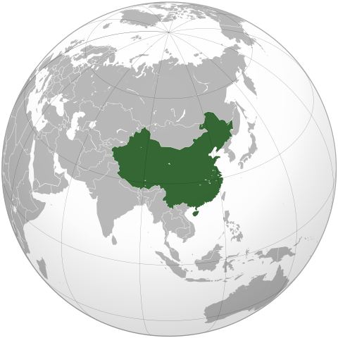
English: The People's Republic of China (green). |
| 日期 | (UTC) |
| 來源 | |
| 作者 |
|
| 其他版本 | 此檔案衍生的作品: Battle of Red Cliffs 208 map-fr.svg |
.svg)
| 這是一張修飾過的圖片,即本圖片是用軟體修改過後的版本,修改的方式或內容有:Removed the claimed territories, showing only controlled territory。原版圖片來源:People's Republic of China (orthographic projection).svg。修改者:Uirauna。
|
我,本作品的著作權持有者,決定用以下授權條款發佈本作品:

|
已授權您依據自由軟體基金會發行的無固定段落、封面文字和封底文字GNU自由文件授權條款1.2版或任意後續版本,對本檔進行複製、傳播和/或修改。該協議的副本列在GNU自由文件授權條款中。 |
|
|
已授權您依據自由軟體基金會發行的無固定段落、封面文字和封底文字GNU自由文件授權條款1.2版或任意後續版本,對本檔進行複製、傳播和/或修改。該協議的副本列在GNU自由文件授權條款中。 |
您可以選擇您需要的授權條款。
該地圖是使用通用製圖工具創建的: https://www.generic-mapping-tools.org/ 使用其中一個或多個公有領域浮雕數據集:
|
|
|
已授權您依據自由軟體基金會發行的無固定段落、封面文字和封底文字GNU自由文件授權條款1.2版或任意後續版本,對本檔進行複製、傳播和/或修改。該協議的副本列在GNU自由文件授權條款中。 |
原始上傳日誌
This image is a derivative work of the following images:
- File:People's_Republic_of_China_(orthographic_projection).svg licensed with Cc-by-sa-3.0,2.5,2.0,1.0, GFDL, GFDL-GMT
- 2009-02-16T20:43:19Z [[User:Shib] 541x541 (492315 Bytes) Reverted to version as of 01:23, 14 February 2009
- 2009-02-16T16:53:16Z Uirauna 541x541 (510234 Bytes) Reverted to version as of 17:30, 9 February 2009 to reflect the NPOV rules, claimed territories should not be marked light green in the map
- 2009-02-14T01:23:58Z Shibo77 541x541 (492315 Bytes) ..
- 2009-02-14T01:09:04Z Shibo77 541x541 (488887 Bytes) Reverted to version as of 01:10, 27 October 2008
- 2009-02-09T17:34:05Z Uirauna 541x541 (510234 Bytes) Sorry, I uploaded the wrong file, this is the correct one.
- 2009-02-09T17:30:31Z Uirauna 541x541 (510234 Bytes) According to the [[Wikipedia:Neutral point of view]] rules, I have removed the light green marks over the regions claimed by PRC but controlled by other nationas, such as Taiwan and Arunachal Pradesh. Other country maps ( suc
- 2008-10-27T01:10:00Z Ssolbergj 541x541 (488887 Bytes) {{Information |Description={{en|1=The People's Republic of China (green) and its claimed territory (lighter green).}} |Source=as |Author=~~~ |Date=27 October 2008 |Permission= |other_versions={{DerivativeVersions|Battle of Red Cliffs 208 map-fr.svg}} }} [[Category:Maps of China]]
Uploaded with derivativeFX
檔案歷史
點選日期/時間以檢視該時間的檔案版本。
| 日期/時間 | 縮圖 | 尺寸 | 使用者 | 備註 | |
|---|---|---|---|---|---|
| 目前 | 2021年3月16日 (二) 21:48 | | 541 × 541(498 KB) | Geographyinitiative | Reverted to version as of 22:28, 16 February 2009 (UTC) It is better to have the admitted inaccuracy of not including South Sudan, which is secondary to the purpose of this image, than to include unusual & mysterious light and dark green circles along the coastline of the Asian mainland in the water implying some kind of territorial jurisdiction not explained in the description of the image. |
| 2013年8月4日 (日) 12:39 |  | 553 × 553(289 KB) | Flappiefh | Added South Sudan. | |
| 2009年2月16日 (一) 22:28 |  | 541 × 541(498 KB) | Uirauna | {{Information |Description={{en|1=The People's Republic of China (green).}} |Source=*File:People's_Republic_of_China_(orthographic_projection).svg |Date=2009-02-16 22:22 (UTC) |Author=*[[:File:People's_Republic_of_China_(orthographic_projection).svg |
.svg)
檔案用途
沒有使用此檔案的頁面。
全域檔案使用狀況
以下其他 wiki 使用了這個檔案:
- ar.wikipedia.org 的使用狀況
- en.wikipedia.org 的使用狀況
- uz.wikipedia.org 的使用狀況
.svg)