
File:Océan Atlantique.png
無更高解析度可提供。
Océan_Atlantique.png (328 × 328 像素,檔案大小:33 KB,MIME 類型:image/png)
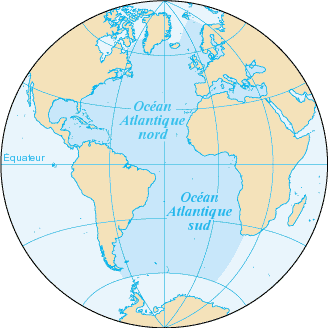
L'océan Atlantique, et ses mers dépendantes, en bleu foncé.
Fond de carte provenant de la CIA, francisé : https://www.cia.gov/library/publications/the-world-factbook/geos/zh.html archive copy at the Wayback Machine
 |
File:Océan Atlantique détourée.png
|
Carte cédée au domaine public.
| 此作品已由其作者,Bra,釋出至公有領域。此授權條款在全世界均適用。 這可能在某些國家不合法,如果是的話: |
檔案歷史
點選日期/時間以檢視該時間的檔案版本。
| 日期/時間 | 縮圖 | 尺寸 | 使用者 | 備註 | |
|---|---|---|---|---|---|
| 目前 | 2005年7月3日 (日) 21:34 | | 328 × 328(33 KB) | Idarvol | typo |
| 2005年6月3日 (五) 20:43 |  | 328 × 328(33 KB) | Idarvol | L'Océan atlantique en bleu foncé. ''Fond de carte provenant de la CIA, francisé. ''Carte cédée au domaine public. {{PD-self|Bra}} |
檔案用途
下列頁面有用到此檔案:
全域檔案使用狀況
以下其他 wiki 使用了這個檔案:
- ady.wikipedia.org 的使用狀況
- avk.wikipedia.org 的使用狀況
- en.wikibooks.org 的使用狀況
- en.wiktionary.org 的使用狀況
- fr.wikipedia.org 的使用狀況
- Bahamas
- Islande
- Vannes
- Océan Atlantique
- Pas de Calais
- La Rochelle
- Sao Tomé-et-Principe
- Groenland
- Golfe de Guinée
- Plouguerneau
- Bénodet
- Clohars-Carnoët
- Combrit
- Fouesnant
- Île-Tudy
- La Forêt-Fouesnant
- Mer d'Irlande
- Mer des Caraïbes
- Golfe du Mexique
- Route du Rhum
- Açores
- Bermudes
- Saint-Pierre-et-Miquelon
- Îles Canaries
- Île de Man
- Gulf Stream
- Montserrat (Antilles)
- Asturies
- Galice
- Casablanca
- Canal de Panama
- Damgan
- Ambon (Morbihan)
- Arzon
- Fort Boyard (monument)
- Anguilla
- Provinces maritimes
- Phare de Cordouan
- Île de Ré
- Jutland
- Îles Malouines
- Saint-Sébastien (Espagne)
- Sercq
- Phare des Baleines
- Catégorie:Islande
- Îles du Salut
檢視此檔案的更多全域使用狀況。