
File:Dead Sea Galilee.jpg

預覽大小:363 × 600 像素。 其他解析度:145 × 240 像素 | 290 × 480 像素 | 465 × 768 像素 | 1,162 × 1,920 像素。
原始檔案 (1,162 × 1,920 像素,檔案大小:645 KB,MIME 類型:image/jpeg)
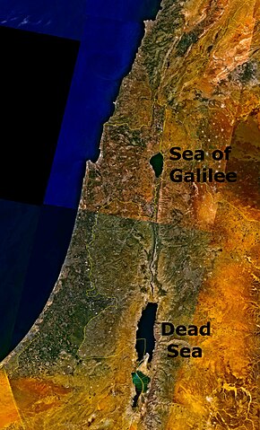
Outdated 1948-1967 geopolitical map depicting Jordanian conquest territory with Dead Sea and the w:Sea of Galilee.
| 本圖像屬於公有領域,因其為NASA的World Wind衛星地圖瀏覽器的一張截圖,且使用了公有領域圖層,如Blue Marble、MODIS、Landsat、SRTM、USGS、GLOBE等。
|
 |
檔案歷史
點選日期/時間以檢視該時間的檔案版本。
| 日期/時間 | 縮圖 | 尺寸 | 使用者 | 備註 | |
|---|---|---|---|---|---|
| 目前 | 2006年8月24日 (四) 18:07 | | 1,162 × 1,920(645 KB) | Interiot~commonswiki | The Dead Sea and the w:Sea of Galilee. Imagery from NASA World Wind. {{PD-USGov-NASA}} Category:Satellite pictures of IsraelCategory:Satellite pictures of Jordan |
檔案用途
下列頁面有用到此檔案:
全域檔案使用狀況
以下其他 wiki 使用了這個檔案:
- bn.wikipedia.org 的使用狀況
- ckb.wikipedia.org 的使用狀況
- da.wikipedia.org 的使用狀況
- el.wiktionary.org 的使用狀況
- en.wikipedia.org 的使用狀況
- en.wiktionary.org 的使用狀況
- fo.wikipedia.org 的使用狀況
- fr.wiktionary.org 的使用狀況
- fy.wikipedia.org 的使用狀況
- id.wikipedia.org 的使用狀況
- kn.wikipedia.org 的使用狀況
- ku.wikipedia.org 的使用狀況
- ml.wikipedia.org 的使用狀況
- ms.wikipedia.org 的使用狀況
- pt.wikipedia.org 的使用狀況
- ro.wikipedia.org 的使用狀況
- sc.wikipedia.org 的使用狀況
- simple.wikipedia.org 的使用狀況
- sl.wikipedia.org 的使用狀況
- sw.wikipedia.org 的使用狀況
- te.wiktionary.org 的使用狀況
- ur.wikipedia.org 的使用狀況
- zh.wikipedia.org 的使用狀況