
File:Map of Taiwan (Formosa) in 1880, from- Stanford's map of the empires of China and Japan with the adjacent parts of the Russian Empire, India, Burma etc. LOC 2006458442 (cropped).jpg

本预览的尺寸:478 × 599像素。 其他分辨率:191 × 240像素 | 383 × 480像素 | 613 × 768像素 | 1,071 × 1,342像素。
原始文件 (1,071 × 1,342像素,文件大小:257 KB,MIME类型:image/jpeg)
摘要
| 描述 |
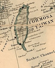
English: Back cover of publishers' list on verso. Front cover missing. "Stanford's Geog. Estab, London." Annotated in pencil in pink. "409410 * '31." LC copy sectioned to 36 sheets, and mounted on cloth backing. Available also through the Library of Congress Web site as a raster image. |
||
| Title | Stanford's map of the empires of China and Japan with the adjacent parts of the Russian Empire, India, Burma &c. | ||
| Shelf ID | G7820 188- .S7 | ||
| 日期 | |||
| 来源 | https://www.loc.gov/item/2006458442/ | ||
| 作者 | Stanford, Edward | ||
| 授权 (二次使用本文件) |
|
||
| 其他版本 | |||
| Location | Burma · Burma. · India · India. · China · Russia. · Japan · China. · Japan. · Russia | ||
| Part of | American Memory · General Maps · Catalog · Geography And Map Division | ||
| Subject | Burma · India · Maps · China · Japan · Russia |


_in_1880,_from-_Stanford%27s_map_of_the_empires_of_China_and_Japan_with_the_adjacent_parts_of_the_Russian_Empire,_India,_Burma_etc._LOC_2006458442_(cropped).jpg?uselang=zh)
_in_1880,_from-_Stanford%27s_map_of_the_empires_of_China_and_Japan_with_the_adjacent_parts_of_the_Russian_Empire,_India,_Burma_etc._LOC_2006458442_(cropped).jpg?uselang=zh)
_in_1880,_from-_Stanford%27s_map_of_the_empires_of_China_and_Japan_with_the_adjacent_parts_of_the_Russian_Empire,_India,_Burma_etc._LOC_2006458442_(cropped).jpg?action=history&uselang=zh)
_in_1880,_from-_Stanford%27s_map_of_the_empires_of_China_and_Japan_with_the_adjacent_parts_of_the_Russian_Empire,_India,_Burma_etc._LOC_2006458442_(cropped).jpg)
许可协议
|
这是一个平面公有领域艺术品的忠实摄影副本。原艺术品本身因为下列原因属于公有领域:
维基媒体基金会的官方立场认为:“对平面公有领域艺术品的忠实再制作品也属于公有领域。”
因此,可以认为此摄影副本在美国也属于公有领域。在其他司法管辖区,再利用此内容可能存在限制;参见再利用PD-Art照片了解详细信息。 | ||||
文件历史
点击某个日期/时间查看对应时刻的文件。
| 日期/时间 | 缩略图 | 大小 | 用户 | 备注 | |
|---|---|---|---|---|---|
| 当前 | 2019年11月4日 (一) 02:51 | | 1,071 × 1,342(257 KB) | Tibet Nation | File:Stanford's map of the empires of China and Japan with the adjacent parts of the Russian Empire, India, Burma etc. LOC 2006458442.jpg cropped 93 % horizontally, 87 % vertically using CropTool with lossless mode. |
文件用途
以下页面链接到本图像:
全域文件用途
以下其他wiki使用此文件:
- en.wikipedia.org上的用途
- en.wiktionary.org上的用途
- id.wikipedia.org上的用途
- ko.wikipedia.org上的用途
_in_1880,_from-_Stanford%27s_map_of_the_empires_of_China_and_Japan_with_the_adjacent_parts_of_the_Russian_Empire,_India,_Burma_etc._LOC_2006458442_(cropped).jpg)