
File:EC map of poland2.png
没有更高的分辨率。
EC_map_of_poland2.png (600 × 548像素,文件大小:332 KB,MIME类型:image/png)
| 描述 |
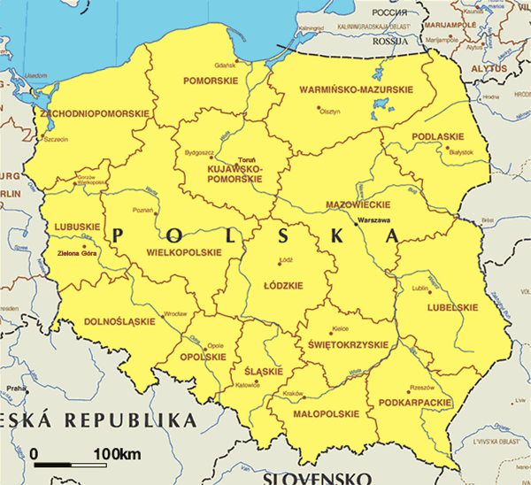
English: Administrative map of Poland. Lambert azimuthal equal-area projection - small correction to Image:EC map of poland.png - regarding voivodship capitals |
| 日期 | Map updated first quarter of 2004. |
| 来源 | Europa - The EU at a glance - Maps - European Commission, Directorate General for Press and Communication. |
| 作者 | Cartography by Lovell Johns. Consultant: BC Geomatique, University of Liege - Uploaded on 2005.02.26 by Micga. |
| 授权 (二次使用本文件) |
- Copyright of this map is owned by the European Commission but reproduction is authorized. |
| 其他版本 | Image:EC map of poland.png |

|
本文件的著作权人,允许任何人在适当地表明著作权人的姓名的前提下,以任何目的使用本文件。传播,演绎作品,商业用途及所有其他用途被允许。 |
|
|
文件历史
点击某个日期/时间查看对应时刻的文件。
| 日期/时间 | 缩略图 | 大小 | 用户 | 备注 | |
|---|---|---|---|---|---|
| 当前 | 2005年5月16日 (一) 20:54 | | 600 × 548(332 KB) | EAJoe~commonswiki | small correction to EC_map_of_poland - regarding voivodship capitals |
文件用途
以下页面链接到本图像:
全域文件用途
以下其他wiki使用此文件:
- be-tarask.wikipedia.org上的用途
- bg.wiktionary.org上的用途
- cs.wikipedia.org上的用途
- en.wikipedia.org上的用途
- en.wiktionary.org上的用途
- gl.wikipedia.org上的用途
- incubator.wikimedia.org上的用途
- sl.wikipedia.org上的用途
- sv.wikipedia.org上的用途